The province of Urubamba in Cusco
The province of Urubamba is made up of some of the most touristic districts in all of Cusco. Among them, the district of Aguas Calientes stands out, where nothing less than the archaeological site of Machu Picchu is located. Inca citadels such as Chinchero, Ollantaytambo, Moray and more also stand out.
All about the province of Urubamba
Explore the province of Urubamba
Urubamba is a province of Cusco famous for hosting the main tourist attractions of the Sacred Valley of the Incas. Know what places to visit in this province. Don’t miss out!
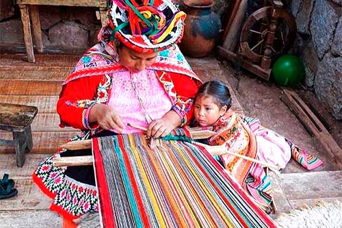
1 Chinchero textile centers
In Chinchero there are dozens of textile centers where llama and alpaca garments are woven and dyed in a traditional way. It is part of the tour to the Sacred Valley.
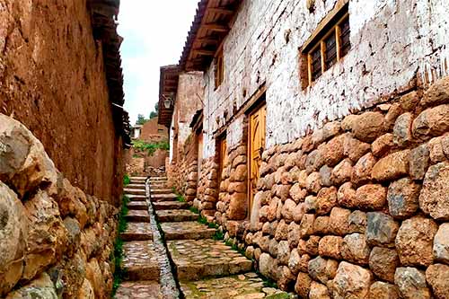
2 Chinchero
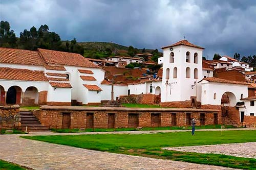
Chinchero is famous for its archaeological site (Túpac Yupanqui Palace). The town stands out for its customs, textile centers, church and clothing.
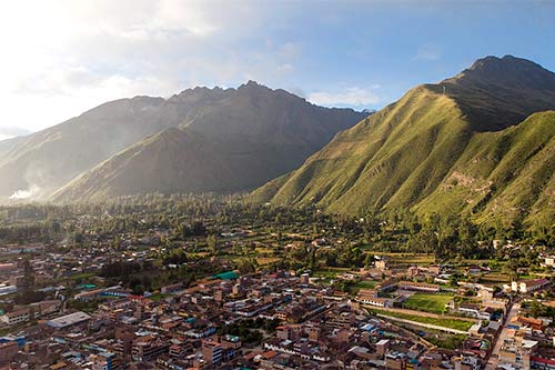
3 Urubamba City
Urubamba is a town located in the Sacred Valley of the Incas. It is famous for the beauty of its landscapes, its pleasant climate and adventure sports.
4 Maras
Maras is a traditional town in the Sacred Valley of the Incas. Its main attractions are the salt mines of Maras and the circular platforms of Moray.
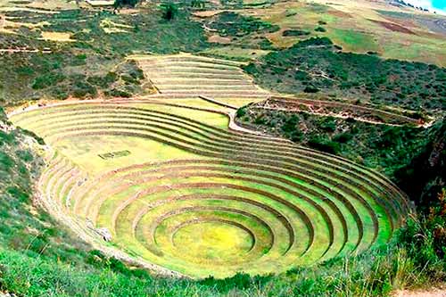
5 Moray
Moray, in the Sacred Valley of the Incas, is 50 kilometers from Cusco in Peru. Tours include guide, entrance fees and transportation and cost $ 60 approx.
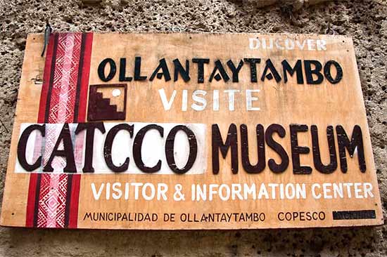
6 Catcco Museum
The museum exposes the history of the town of Ollantaytambo, famous for its archaeological site and beautiful crafts. It is located in the Sacred Valley of the Incas.
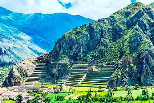
7 Ollantaytambo
Ollantaytambo is an Inca town and city in the Sacred Valley of the Incas. It has temples, walls, platforms and more. From there the train to Machu Picchu departs.
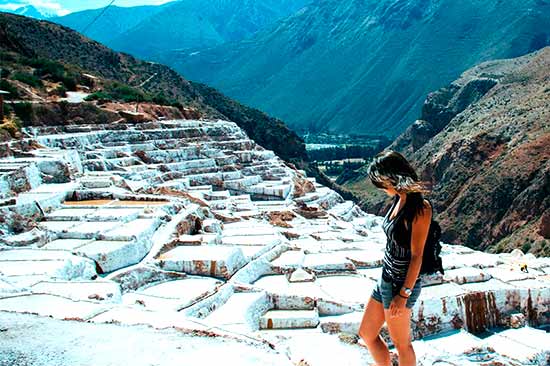
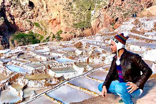
8 Maras Salt Mines
The Salineras de Maras in Cusco, Peru are hundreds of natural salt wells used since the Incas. You can go with a tour package that includes Moray.

9 Ollantaytambo archaeological site
This archaeological site has structures as imposing as Machu Picchu. It is located in the town of Ollantaytambo, in the Sacred Valley of the Incas.
10 Chinchero archaeological sites
Chinchero is famous for its archaeological site, the ancient palace of Túpac Yupanqui. To visit it, you must buy a tour or the Cusco Tourist Ticket.
11 Yucay
Yucay is a town in the Sacred Valley of the Incas famous for its pleasant climate, the ancient palace of the Incas Huayna Capac and Sayri Túpac and much more.
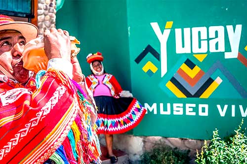
12 Yucay Museum of Living Culture
The museum shows some of the customs of the peoples of the Sacred Valley of the Incas such as: their textiles, their gastronomy, their drinks, ceramics and more.
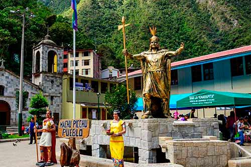
13 Aguas Calientes
Aguas Calientes is also known as Machu Picchu town. It has hotels, bars, restaurants, markets, hot springs and bus and train stations.
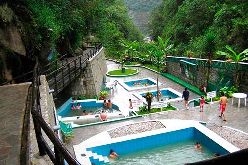
14 Aguas Calientes thermal baths
The thermal baths of Aguas Calientes are 10 kilometers from Machu Picchu. It is open daily from 5 am to 8 pm. The cost is 20 Peruvian soles.
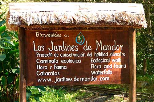
15 Mandor Gardens
This natural area is full of trees, flowers and wild animals. It is only 30 minutes from Machu Picchu town. It includes the Mandor waterfalls.
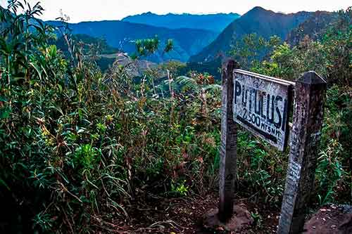
16 Putucusi Mountain
The Putucusi is one of the 3 summits that surround Machu Picchu along with the Huayna Picchu and the Machupicchu mountain. The hike is difficult. The entrance is free.
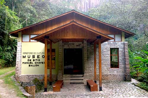
17 Machu Picchu Site Museum
The Manuel Chávez Ballón Museum is located in the town of Aguas Calientes, a short distance from Machu Picchu. It exhibits Inca pieces as well as panels and photos.
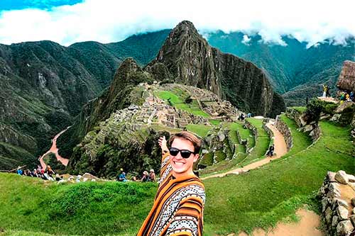
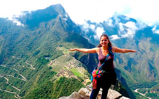
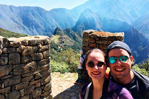
18 Machu Picchu
Know all that you can see in Machu Picchu: Temple of the Sun, Temple of the Moon, Main Temple, Royal Tomb, Intihuatana, Intipunku, Sacred Rock and more.
19 Huayna Picchu
The Huayna Picchu mountain is the best adventure in Machu Picchu. It offers an incredible walk, beautiful landscapes, the great cavern as well as flora and fauna.
20 Huchuy Picchu mountain in Machu Picchu
Huchuy Picchu offers a new hiking route in Machu Picchu. It is located next to Huayna Picchu. The ticket must be purchased online.
21 Intipunku
The Intipunku (Sun Gate in Quechua) was the ancient access route to Machu Picchu of the Incas. Today it is a short walk. It takes 1 or 2 hours to get there.
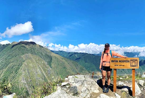
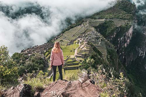
22 Machu Picchu Mountain
Machu Picchu mountain is the highest mountain in the Inca city. The hike to the top is demanding. You will be able to see beautiful landscapes, flora, fauna and more.
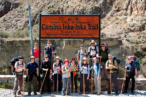
23 Inca Trail
The Inca Trail is a 4-day, 3-night route to Machu Picchu. It runs through part of the qhapac ñan (Inca road network) to the Intipunku (Sun Gate).
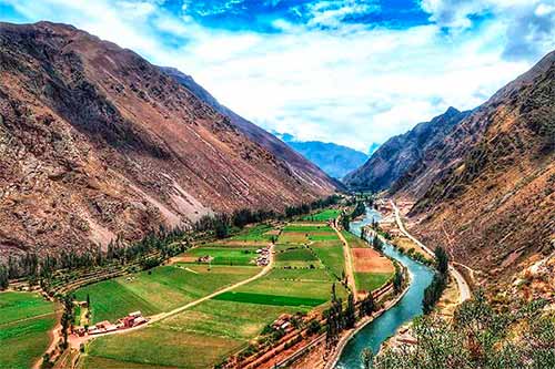
24 The Sacred Valley of the Incas
The Sacred Valley was a very important Inca agricultural area where temples and platforms such as Pisac, Chinchero, Ollantaytambo, Moray and Machu Picchu were built.
The capital of the Sacred Valley of the Incas
In the province of Urubamba are the majority of Inca citadels and Andean towns that make up the famous ‘Sacred Valley of the Incas’.
The province of Urubamba is made up of seven districts: Chinchero, Huayllabamba, Machupicchu (Aguas Calientes), Maras, Ollantaytambo, Urubamba (capital) and Yucay.
During the Inca era, its fertile lands were used to build extensive terraces and platforms. Corn was mainly produced there.
The Incas also built their main citadels in the mountains of Pisac, Chinchero and Ollantaytambo. Near the town of Maras they built a circular agricultural center called ‘Moray’.
During the colonial era the Spanish built baroque churches in the first Indian reductions, which would later become Andean villages of great beauty.
Today the province of Urubamba offers dozens of tourist attractions for the visitor. This has caused the proliferation of hotels, restaurants and other tourist services, some of which are of a very good standard. An international airport is even being built in the town of Chinchero.
Where is?
The town of Urubamba, the capital of the province of the same name, is located 53 kilometers by road from the city of Cusco. Urubamba is located at 2,871 meters above sea level.
The geography of the province of Urubamba is marked by the presence of the Vilcanota River as well as high snow-capped mountains such as Salkantay, Chicón, El Verónica and more.
The province of Urubamba is located northeast of the city of Cusco. It limits with the provinces of Calca, Anta and La Convencion.
Much of its territory is made up of mountains and valleys. However, it also has high tropical jungle, such as the district of Machupicchu.
How to get there from Cusco?
To get to the district of Urubamba (capital of the province of the same name) by public transport, follow the following route:
- From any part of the city of Cusco you must take a taxi or public transport bus to Pavitos street. Another option is to go on foot as this street is only 900 meters from the city’s Main Square.
- The public transport minivans will take the visitor to the town of Urubamba. The trip takes approximately 1 hour 30 minutes. The cost of the trip is approximately 8 Peruvian soles.
- Once in the town of Urubamba, tourists can take other public transport buses to nearby towns such as Ollantaytambo. In this last town you board the train to Machu Picchu .
Urubamba province map
History of the province of Urubamba
The territory of Urubamba was occupied by various ethnic groups who were subjugated or annexed to the nascent Inca empire in the 13th and 14th centuries. During the Inca times, the fertile territory was used for the cultivation of potatoes, corn, quinoa and more. The most important citadels built by the Incas were located in the current districts of Chinchero, Urubamba, Ollantaytambo and Yucay.
With the invasion of the Spanish in the 16th century, the Inca temples were destroyed. In its place baroque colonial temples were built. In addition, the so-called ‘indian reductions’ were created, which would become the current towns and districts of the province. In 1825 the province of Urubamba was created. In 1839 the district of the same name was chosen as its capital. Due to its fertile lands as well as its Inca towns and citadels, the territory of Urubamba is also currently called ‘The Sacred Valley of the Incas’.
Main tourist attractions
These are the main tourist attractions in the province of Urubamba:
- Archaeological site of Chinchero – Emperor Tupac Yupanqui had his palace built in this town. With the arrival of the Spanish this was destroyed. In its place the Spanish built the temple of Our Lady of the Nativity. Of the immense palace there remain some walls, doors, stairways as well as an immense set of platforms, squares and paths.
- Salt Mines of Maras – Just 7 kilometers from the town of Maras there are hundreds of natural salt wells formed millions of years ago. Salt was well used by the Incas. Today the local inhabitants distribute it through the markets of Cusco. The set of salt pools offers an amazing landscape.
- Moray Circular Platforms – Moray is a set of circular platforms of large and small dimensions, which offer a view much photographed by visitors. There the Incas experimented with the cultivation of various agricultural products, some produced in distant regions as the Moray platforms offer various microclimates.
- Ollantaytambo Archaeological Site – This Inca citadel and temple displays some of the heaviest and most finely carved constructions of the Incas in Cusco. There the Incas faced the Spanish in 1537. Because of this many structures were damaged. However, you can still see constructions as immense as the temple of the sun, the enclosure of the 10 niches or the baths of the ñusta.
- Machu Picchu – Machu Picchu was an Inca citadel that stands out for its fine stone constructions as well as for the wonderful and harmonious landscape in which it was built. It was the emperor Pachacutec who had it built in approximately 1450. Today it is recognized as one of the 7 wonders of the modern world. It is located just 10 kilometers from the district of Aguas Calientes.
Weather
The climate in the town of Urubamba (capital of the province) is temperate and warm. The temperature varies from a maximum of 23ºC. up to a minimum of 4ºC. at certain times of the year. The average temperature is 11ºC.
April to October is the dry season. In those months the rains are not frequent (the geography becomes dry). Also the nights are colder. From November to March the rainy season occurs. In those months it rains more often. The nights are less cold.
Photo gallery
Additional Information
The province of Urubamba covers an approximate area of 1,439 square kilometers. Some 80,175 inhabitants live there. The town of Urubamba is the capital of the province. It is situated at 2,871 meters above sea level. This town has the best hotel and restaurant services.
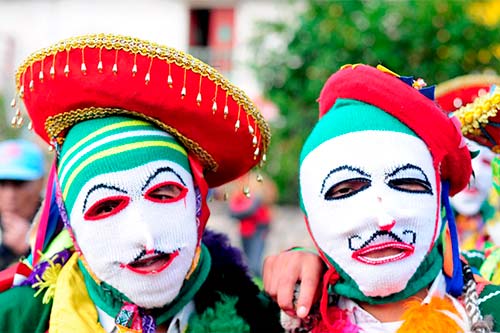
Each town celebrates its festivities with music, dance, lots of joy and faith. Some of the most recommended festivities are the ‘Festivity of Torrechayoc’ (in Urubamba on May 15), the ‘Festivity of the Lord of Choquekillka’ (in Ollantaytambo on May 31) as well as the carnivals of Chinchero, Yucay, Maras and more.